Walking
The Faroe Islands on foot, between Shetland and Iceland
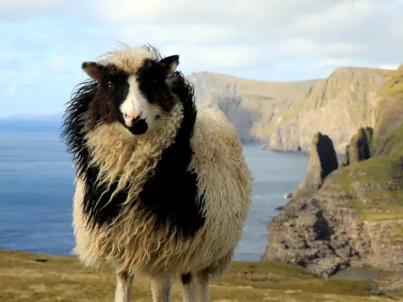
Eighteen steep green islands in the North Atlantic, more sheep than people, turf-roofed houses, sea cliffs full of puffins and a waterfall that drops straight into the ocean. The Faroes are best seen on foot, along the old paths that once linked their villages.
By Walter Pellow2 November 20264 min read
The Faroe Islands lie roughly halfway between Shetland and Iceland, a cluster of eighteen islands rising sheer out of the North Atlantic. They are a self-governing nation within the Kingdom of Denmark, with their own language, their own parliament, one of the oldest in the world, and a population of a little over fifty thousand. Their name is usually explained as meaning sheep islands, and there are indeed more sheep than people.
The islands are the remains of ancient lava flows, cut by glaciers into steep valleys and fjords and then battered by the sea into cliffs. There are almost no trees. Instead there is grass, of a green so intense that it looks unreal, covering the slopes right up to the summits, and on a clear day the views across the sounds to the other islands are extraordinary.
Paths between the villages
Until the twentieth century, there were no roads in the Faroes. Villages were linked by boat, and over land by paths across the mountains, marked by cairns so that travellers could find their way in the frequent fog. Many of these old paths survive, and they make the best walking routes: from one village to the next, over a pass, with the sea below on both sides.
Today the islands are linked by an excellent network of roads, bridges and tunnels, including undersea tunnels between some of the islands. That makes it easy to reach the start of a walk, though in places it has taken the traffic away from the old routes.
The views across the sounds to the other islands are extraordinary.
Mykines and Vágar
Mykines, the westernmost island, is a small, steep island with a single village and some of the best bird cliffs in the North Atlantic. In summer, puffins nest in burrows in the grassy slopes above the cliffs in their thousands, along with gannets, guillemots and fulmars. A path leads from the village across the cliffs and over a footbridge to the islet of Mykineshólmur and its lighthouse, with puffins all around. The island is reached by a small ferry or helicopter, both very dependent on the weather.
On Vágar, the island with the airport, the village of Gásadalur has one of the most photographed sights in the Faroes, the Múlafossur waterfall, which drops straight from the clifftop into the ocean beside the village. Until a tunnel was built in 2004, the village could only be reached over the mountain on foot. Nearby, the lake of Sørvágsvatn lies above the sea on the edge of a sheer cliff, so that from the right viewpoint it seems to hang high above the ocean.
The north and Tórshavn
The northern islands are the most dramatic. Eiði and Gjógv, on the island of Eysturoy, are villages beneath the highest mountains in the Faroes; Gjógv is named after a narrow gorge used as a harbour, and both are surrounded by walks along cliffs and up to viewpoints over the sea stacks known as the Giant and the Witch. Klaksvík, the second town, is a fishing port on Borðoy, from which a road and tunnels lead to Viðoy, where the cape of Enniberg is one of the highest sea cliffs in Europe.
Tórshavn, the capital, is one of the smallest capitals in the world, with an old quarter of turf-roofed wooden houses on a rocky point by the harbour, where the parliament has met since Viking times. A short ferry ride takes you to Nólsoy, a small island with a single village and a long walk to its lighthouse.
The holidays
Explore Worldwide's Walking in the Faroe Islands, seven nights, covers the islands on foot, with Vágar and Sørvágur, Mykines, Gásadalur, Vestmanna, Sørvágsvatn, Eiði, Gjógv, Klaksvík and Viðoy, Tórshavn and Nólsoy. It runs in June, July and August.
Ambassador Cruise Line's Volcanic Landscapes of Iceland and the Faroes, thirteen nights, sails from London Tilbury in June and calls at Runavík and Klaksvík in the Faroes, then Akureyri, Ísafjörður and Reykjavík in Iceland, and Invergordon in Scotland. Ambassador's Land of Fire & Ice & the Faroes, twelve nights, from London Tilbury in August, also calls at Runavík and Klaksvík.
Summer is the walking season, from June to August, when the days are very long and the puffins are on the cliffs. The weather is famously changeable at any time of year: rain, fog and sunshine can follow each other within an hour, and it is rarely warm. Good waterproofs, warm layers and a flexible plan are essential. When the clouds lift, the reward is a landscape like nowhere else.
By Walter Pellow, the name Atlas & Passage’s editorial team writes under. Prices and dates in the trips below come from the operators and can change.