History
Iceland by the ring road, in eight days
Route 1 circles the entire island and was only completed as a continuous road in 1974. Following it end to end is still the most direct way to understand what Iceland actually is.
By Arthur Penhallow26 September 20265 min read
Iceland's Ring Road, officially Route 1, runs roughly 1,300 kilometres around the island's coast, and it is younger than it looks on a map: the final bridge, over the glacial outwash plain of Skeiðarársandur in the south-east, wasn't completed until 1974, which means the country only became fully circumnavigable by car within living memory. Before that, communities in the east and south lived considerably more cut off from the capital than the map's neat coastal line ever suggested.
The delay wasn't a lack of ambition; the terrain simply made it genuinely difficult. Skeiðarársandur, the outwash plain the final bridge crosses, is periodically reshaped by glacial flood surges from the ice cap above it, sudden and occasionally destructive releases of meltwater that any permanent road there had to be engineered to survive. Building across it was, in a very literal sense, building across a landscape that hadn't finished deciding its own shape.
A country still being made
Þingvellir, usually the first proper stop out of Reykjavík, is not just historically significant, as the site of the Alþingi, one of the world's oldest parliaments, established around 930; it sits directly in the rift valley where the North American and Eurasian tectonic plates are pulling apart, a few centimetres further every year. Visitors walk, quite literally, between two continents in the process of separating, which is a fact geology can prove and history happens to have chosen as the founding site of Iceland's national assembly. Neither the parliament nor the plate boundary was arranged with the other in mind; it is simply where the flat, dramatic ground happened to be.
The Alþingi met here in the open air, at a natural rock formation known as the Lögberg, or Law Rock, for over eight centuries before moving indoors to Reykjavík in the nineteenth century, which makes Þingvellir less a ruin than a site that simply changed how it was used rather than falling out of use entirely. Iceland's modern parliament still traces its institutional history back to the assemblies held on this exact ground.
Ice, fire and the coast between them
Further round the ring, the landscape keeps making its own argument for Iceland's volcanic origins. Vatnajökull, Europe's largest ice cap by volume, feeds glacial rivers and, at Jökulsárlón, calves icebergs into a lagoon that drifts them slowly out to a black sand beach known, for obvious reasons once you've seen it, as Diamond Beach. Nearby, waterfalls like Skógafoss and Seljalandsfoss drop from cliffs that were themselves once sea cliffs, before the coastline retreated to its current line, and the black sands and basalt columns at Reynisfjara, near the village of Vík, are the visible result of lava meeting the Atlantic rather than any process more gradual.
The glacial lagoon at Jökulsárlón didn't exist a century ago in anything like its current form; it has grown steadily as the glacier feeding it has retreated, a visible, ongoing process rather than a fixed landmark, and it is a useful reminder that this whole coastline is still actively changing on a timescale a single visit can only glimpse a fraction of.
The geothermal heartland
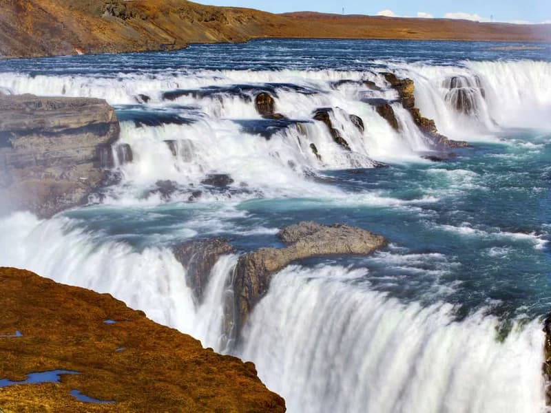
In the north, the area around Lake Mývatn shows the same volcanic story from a different angle: bubbling mud pools, lava fields at Dimmuborgir shaped into towers and arches by cooling gas bubbles, and Goðafoss, the "waterfall of the gods", said in tradition to take its name from pagan idols thrown into it when Iceland formally adopted Christianity around the year 1000. Akureyri, the country's second city on the Eyjafjörður fjord, makes a natural pause here, a proper working town after days of increasingly dramatic but sparsely populated coastline.
That conversion in the year 1000 is itself a fairly remarkable piece of history: the Alþingi is said to have decided the matter by a single lawspeaker's ruling, adopted as a pragmatic compromise to avoid the country splitting into rival Christian and pagan factions, with private worship of the old gods quietly tolerated for a time afterwards. Whether or not any idols were literally thrown into Goðafoss, the waterfall's name has carried the story for over a thousand years regardless.
Doing it properly takes about a week
A full circuit, with time to actually stop rather than simply drive, takes the best part of eight or nine days, which is roughly what an escorted coach tour of the ring road allows for. It is not a trip that rewards rushing; distances between the genuinely striking stops are often considerable, and Iceland's weather, changeable at the best of times, has a way of making an ambitious schedule look foolish by the third day. Arthur would rather see less of the ring road properly than all of it from a moving coach window.
What the road actually proves
The Ring Road's real achievement isn't scenic, though the scenery does the selling; it is that it finally connected communities that had, for centuries, related to each other and to Reykjavík mostly by sea or not at all. Driving it end to end, even at a comfortable pace over a week, makes that isolation, and its relatively recent end, considerably easier to understand than reading about it ever quite manages.
It is worth setting out on the trip with that in mind rather than treating it purely as a checklist of waterfalls and glaciers. Every small fishing town the road passes through, in the east in particular, spent generations reachable more easily by boat than by land, and the road that finally changed that is, in its own quiet way, as much a part of Iceland's modern story as the volcanoes either side of it.
By Arthur Penhallow, the name Atlas & Passage’s editorial team writes under. Prices and dates in the trips below come from the operators and can change.