Journeys
The cliffs that explain the Wild Atlantic Way
Ireland's west coast has one famous wall of rock and two and a half thousand kilometres of signposted road built to lead you towards it. Seen from a ship, both make rather more sense.
By Arthur Penhallow26 September 20264 min read
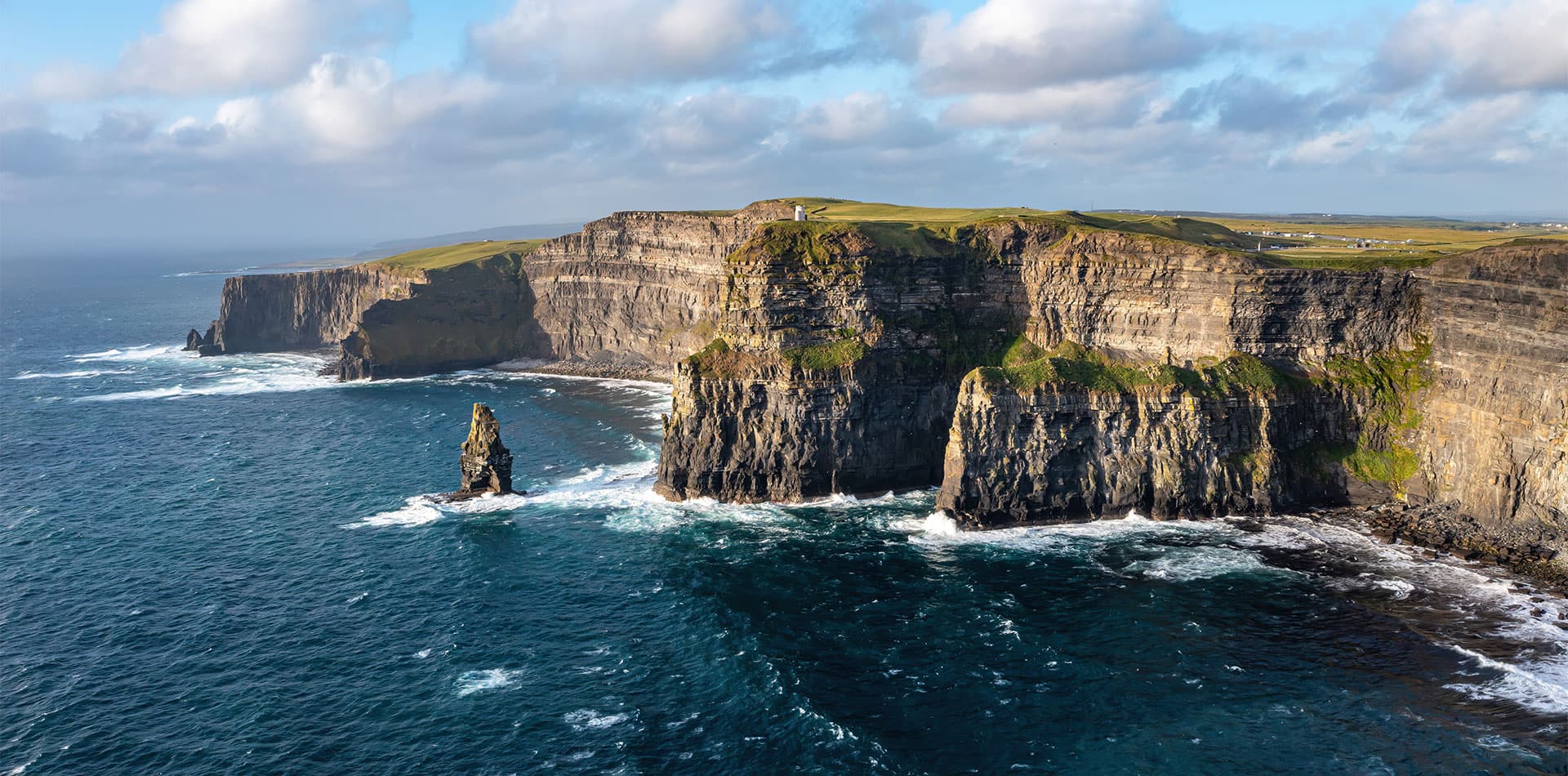
The Cliffs of Moher rise for about eight kilometres along the coast of County Clare, reaching over two hundred metres at their highest point, and they do it with almost no warning: the land runs flat and green to the very edge, then simply stops, dropping sheer into the Atlantic below. They are Ireland's single most visited natural attraction, which is a title that could easily have gone to somewhere less genuinely dramatic, and for once the crowds and the cliffs are in fair proportion to each other.
The rock itself is around 320 million years old, laid down as sand, silt and mud in a river delta long before the Atlantic existed in its current shape, and the alternating bands of sandstone and shale visible in the cliff face are the compressed remains of that ancient delta's shifting channels. Immediately inland lies the Burren, a stark expanse of exposed limestone pavement that shares the same geological story from an earlier chapter, and the two landscapes together give this stretch of Clare a claim to some of the most legible rock in Ireland, if you know roughly what you are looking at.
A coast that needed a name
For most of their history, cliffs like Moher were simply local landmarks, admired by whoever lived nearby and largely unknown beyond. That changed in 2014 with the launch of the Wild Atlantic Way, a signposted touring route running some 2,500 kilometres from County Donegal in the north to County Cork in the south, built by the Irish tourist board to string together the west coast's scattered highlights, Moher among the most prominent of them, into a single coherent journey. It was, in effect, an act of branding applied to a coastline that had always been spectacular but had never been packaged as one continuous thing, and it worked well enough that the name has since become the coast's own shorthand, used by locals and visitors alike regardless of whether they are actually following the signposted road.
The land runs flat and green to the very edge, then simply stops, dropping sheer into the Atlantic below.
Seen from a ship rather than a car, the same coastline reveals itself in a different order: not a road unrolling past viewpoints, but a series of dramatic set pieces glimpsed from the water, with Moher itself usually taken in as a sail-by rather than a landing, since there is no harbour beneath the cliffs for a vessel of any size to use. The cliffs' seabird colonies, including puffins on the smaller islands nearby, are often visible from the deck in early summer, when the birds are ashore to nest.
Galway, and the bay that frames it
Most itineraries pair the Moher sail-by with a call at Galway, the city that sits at the point where the Wild Atlantic Way's central stretch turns from open ocean into the long, sheltered reach of Galway Bay. Galway's own harbour looks out towards the Aran Islands on a clear day, and the city has grown, over recent decades, from a regional port into one of Ireland's more culturally confident smaller cities, a reputation the Wild Atlantic Way branding has only reinforced rather than created.
Which sailings take in the coast
Fred. Olsen's Scenic Landscapes of Ireland, eight nights from Liverpool, combines the Cliffs of Moher sail-by with a call at Galway and, further north, the even higher cliffs at Slieve League in Donegal, on a route that also crosses to Dún Laoghaire near Dublin.
Fred. Olsen's Ireland's Coastal Charms, ten nights from Newcastle, spends longer on this stretch of coast, cruising what it calls the Wild Atlantic Way in County Mayo before the Moher sail-by and a call at Galway, while the shorter Legends and Landmarks of Ireland, seven nights from Southampton, links the same cliffs to Killybegs and Cobh.
None of it substitutes for standing at the cliff edge in a stiff onshore wind, which remains the definitive way to understand why this coast needed its own road in the first place. But a ship's-eye view, taken at a respectful distance and without the car park, has its own honest claim on the same view.
By Arthur Penhallow, the name Atlas & Passage’s editorial team writes under. Prices and dates in the trips below come from the operators and can change.