Walking
The Lycian Way, and the league that named it
Long before it was a long-distance footpath, Lycia was a confederation of city-states with an unusually democratic constitution, tucked into the mountains of Turkey's southern coast.
By Arthur Penhallow26 September 20264 min read
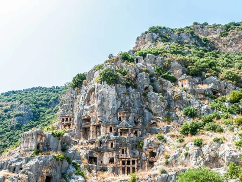
Ancient Lycia occupied a mountainous, sea-facing stretch of what is now south-western Turkey, and its most distinctive legacy is not a single monument but a habit: the Lycians carved their tombs, elaborately, into cliff faces and freestanding rock, in imitation of wooden house fronts, leaving entire hillsides above their old cities pockmarked with doorways that lead nowhere but a burial chamber. The effect, wherever the trail passes beneath one, is of a city that never quite finished building itself, several thousand years after anyone last used the front door.
A federation, not an empire
Lycia was not ruled by a single king but organised as a league of city-states, each sending representatives to a shared council in proportion to its size and importance, an arrangement historians consider one of the more sophisticated systems of federated government in the ancient world. Xanthos, the largest of the Lycian cities and now a UNESCO World Heritage Site, served as the league's most prominent member, its ruins including some of the finest examples of Lycian rock tombs anywhere on the coast. The city changed hands repeatedly over the centuries, ruled in turn by Persians, incorporated into Alexander's empire, and later absorbed into Rome, yet it kept a distinct local identity, visible in its tombs and inscriptions, long after Lycian independence itself had ended.
A path marked out by one determined walker
The Lycian Way itself is a modern creation laid over an ancient landscape: a waymarked long-distance trail of several hundred kilometres along the coast, established in the late 1990s largely through the efforts of one British-born resident of Turkey, who mapped and marked the route using old shepherds' paths, Roman roads and stretches of coastline that had never been formally connected before. It now ranks among the best-known long-distance trails in the eastern Mediterranean, walked in sections rather than end to end by most visitors.
A city that never quite finished building itself.
Sunken walls and a saint's birthplace
Along the way, the trail passes Kekova, where an earthquake in antiquity submerged part of the ancient settlement of Simena, leaving building foundations and stone staircases visible just beneath the surface of unusually clear water. Patara, further along, combines one of the longest sandy beaches on the coast with the ruins of a major Lycian and later Roman port, and holds a claim to fame beyond archaeology: it is traditionally identified as the birthplace of St Nicholas, who later served as bishop in nearby Myra and whose reputation for generosity eventually travelled a very long way from this coastline, transforming over the centuries into Santa Claus.
A short crossing into Greece
Some sections of the route come close enough to the Greek island of Meis, also known as Kastellorizo, that a short boat crossing from Kas is a natural add-on rather than a detour, a reminder that this coast has always looked outward to the Aegean as much as inland to Anatolia. The island sits only a couple of miles offshore, close enough to see clearly from the Turkish coast path on a clear day, and its harbour, ringed by pastel-coloured houses, is a deliberate change of register from the ancient tombs and mountain paths on the Turkish side.
Why the coast rewards walking it
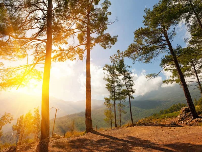
Few visitors walk the entire Lycian Way in one continuous stretch; most tackle a section of several days at a time, based from a single coastal town, with transport arranged for the trickier stages and the option to rejoin the trail at a different point another year. That piecemeal approach suits the terrain as much as it suits most people's holiday time: the path alternates between shaded pine forest, exposed limestone ridges with long sea views, and short, steep descents into the fishing villages and coves that break the route up every few hours.
None of this is visible from a coach window in the way it is from the trail itself: the tombs need to be walked up to and looked into, the sunken walls at Kekova need a slow pass by boat or a good vantage point on foot, and the scale of a Lycian hillside city only really registers once you have climbed part of it. The Lycian Way turns a coastline that could easily be reduced to a string of resort towns back into what it actually is, a landscape still carrying the outline of a confederation that governed itself rather better than most of its contemporaries.
By Arthur Penhallow, the name Atlas & Passage’s editorial team writes under. Prices and dates in the trips below come from the operators and can change.